 Back to the project
Irrigation of the future: sources of information for property and regional management
Robust conceptual frameworks for estimating crop water consumption, coupled with information sources based on modern technologies, enable efficient irrigation management at the plot and regional levels.
Context of the story
Water use competition between economic sectors, increasing food demand and the evident effects of climate change, foreshadow limitations in water availability for agriculture. In contrast, the efficiency of water use in agriculture is only 50%. Today, the wide range of technology allows the use of robust conceptual frameworks to accurately establish crop water consumption and the contribution of irrigation. In this sense, the availability of satellite-based vegetation indices is a great advance as a source of information on the development of crops at the parcel and/or regional scales. Having this information openly available to inform decisions on irrigation management represents a quantitative advance for improving water efficiency.
Crop water consumption can be estimated at two work scales: plot and region.
The implemented initiative
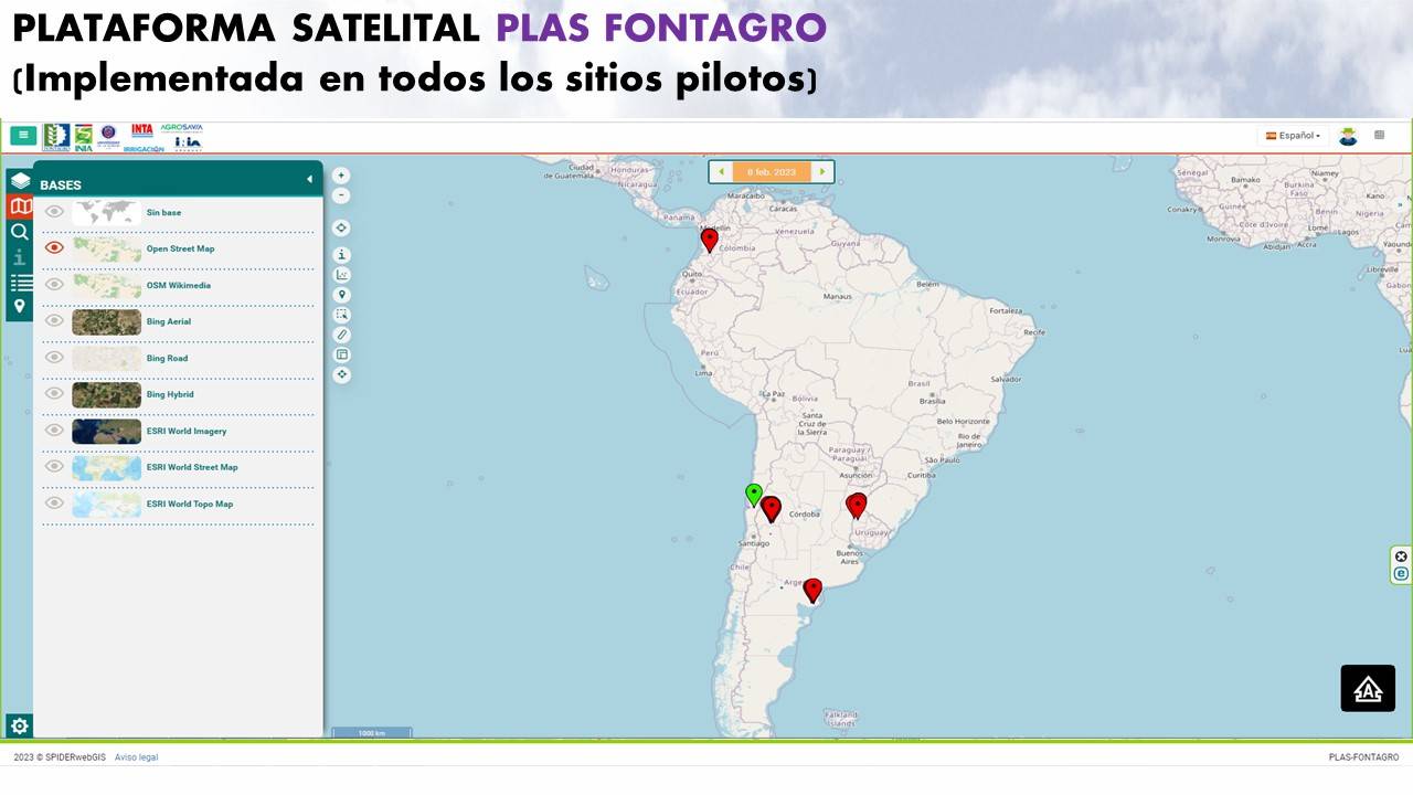
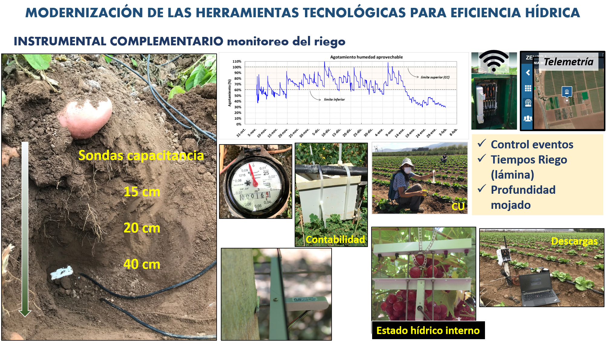
The objective is to improve water use efficiency in agriculture of LAC countries. For this, robust conceptual frameworks and modern technologies are used that generate useful information for irrigation management. This project is developed in pilot studies in Chile, Argentina, Colombia and Uruguay, where the conceptual-technological framework is implemented across two work scales: plot and region. The technological tools used are satellite imagery (Platform Map Web Server - PLAS) and sensors of environmental demand and water availability in the soil. In this way, information with high spatial and temporal resolution is available, transforming traditional irrigation management into informed systems, which allow the implementation of methodologies to improve the efficiency of water use.
Satellite images allow the monitoring of crop development in a frequent and economical manner and make efficient irrigation management operational.
The technological solution
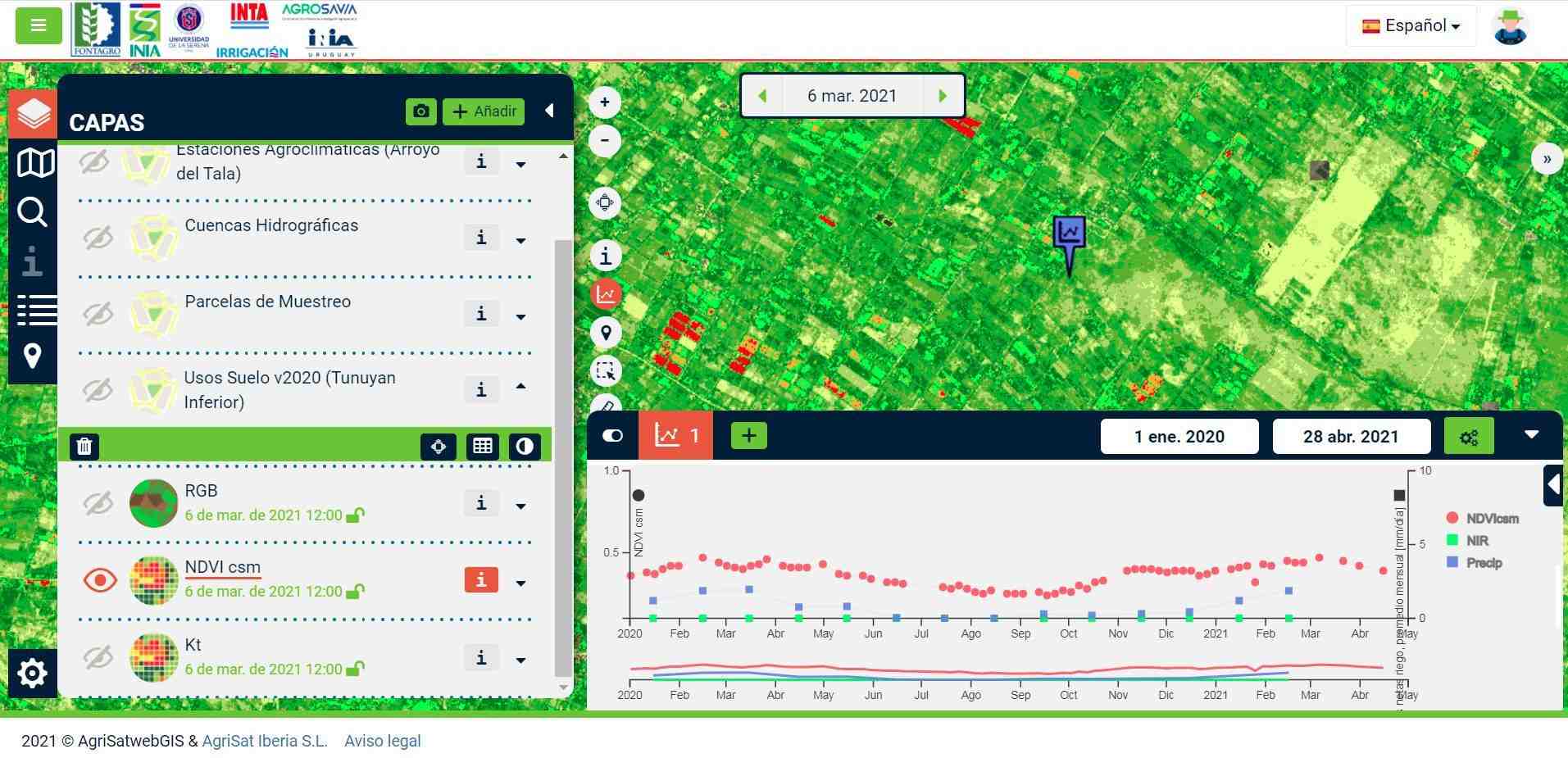
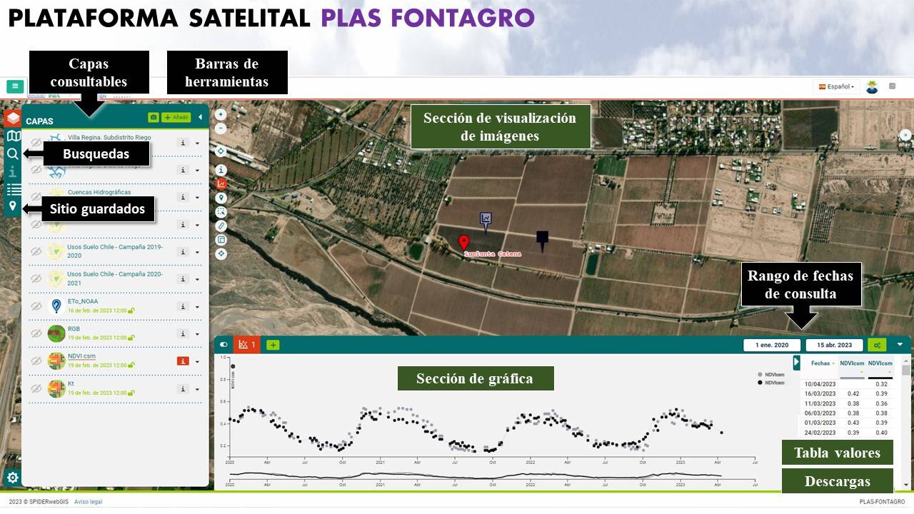
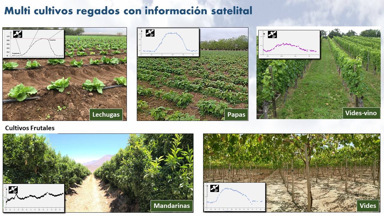
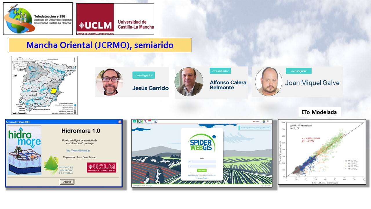
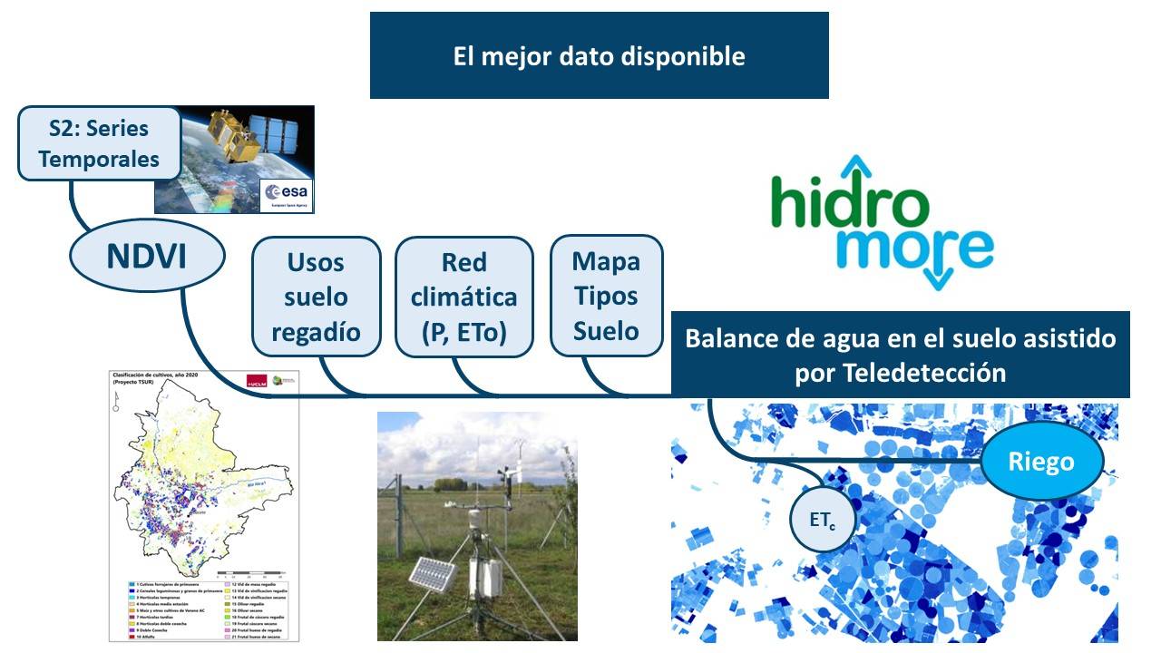
Scientific works on satellite remote sensing has demonstrated the ability of vegetation indices (VI) to assess the development of crops and estimate their evapotranspiration (ETc). The rationale is based on the ability of VIs to estimate the fraction of crop cover, the absorption of photosynthetically active radiation (fPAR) and the leaf area index, all parameters of the transpiration rate and biomass production of crops. From sequences of satellite images it is possible to estimate the amount of vegetation displayed by the crop and the ability to transpire against environmental demands. The PLAS FONTAGRO platform is routinely updated with NDVI vegetation index images from the Sentinel 2A and 2B satellites. The transformation of the NDVI to a strategic irrigation parameter such as the crop coefficient (Kc), together with the environmental demand, enables the estimation of crop water consumption and therefore irrigation rate.
THE EXPERIENCES GATHERED DURING THE PAST 30 YEARS SUPPORT THE OPERATIONAL USE OF IRRIGATION SCHEDULING BASED ON FREQUENT MULTI-SPECTRAL IMAGE DATA.
 Chile
Chile Argentina
 Colombia
 Spain
Spain Uruguay
Results
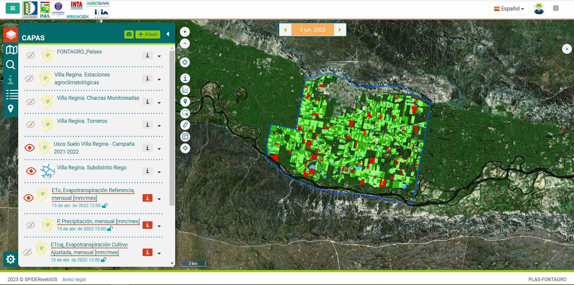
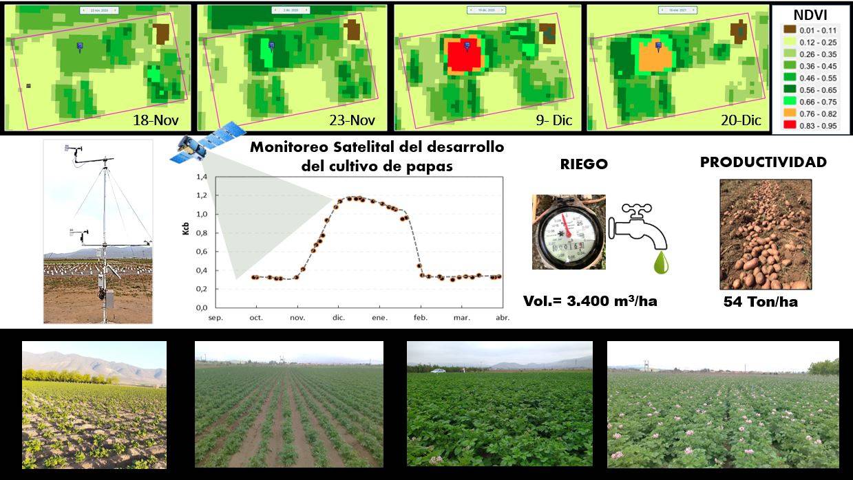
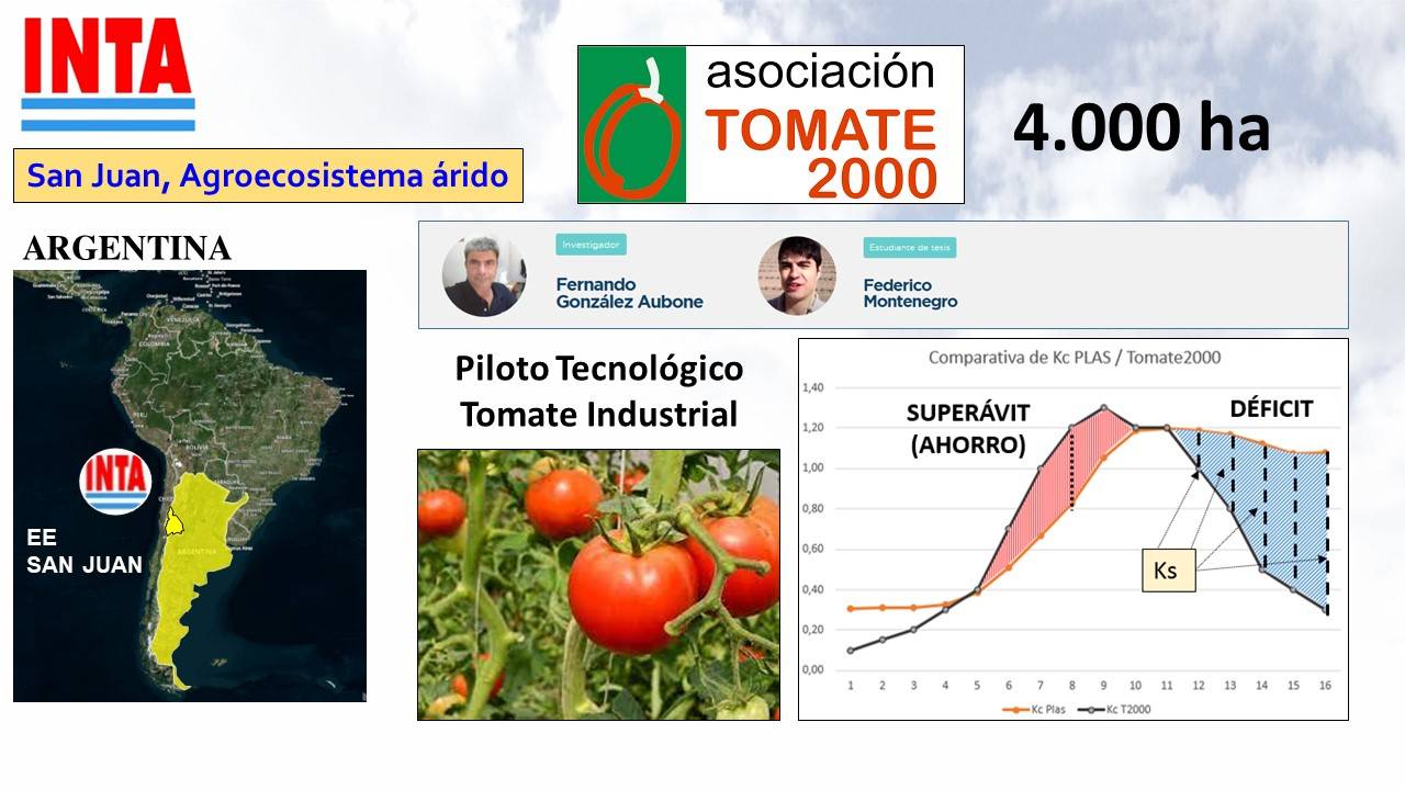
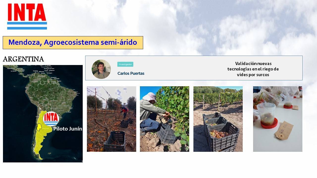
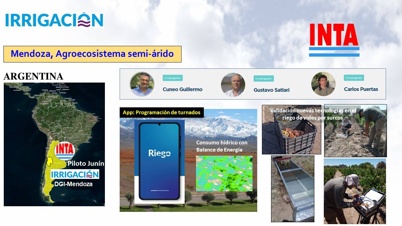
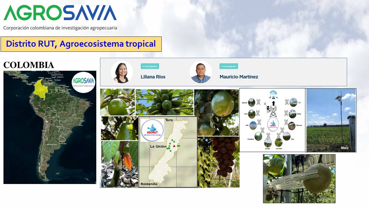
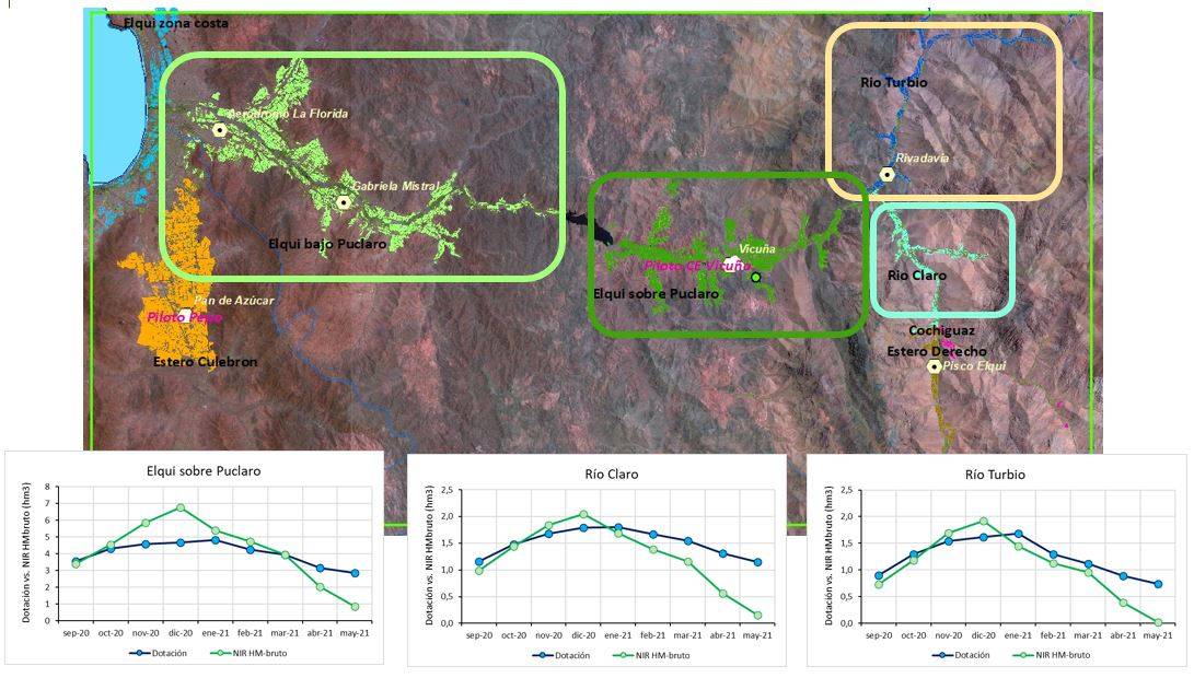
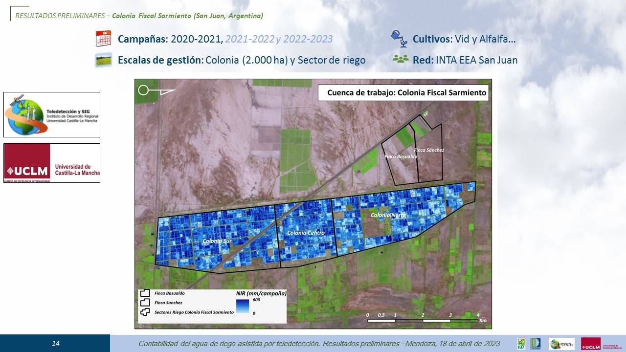
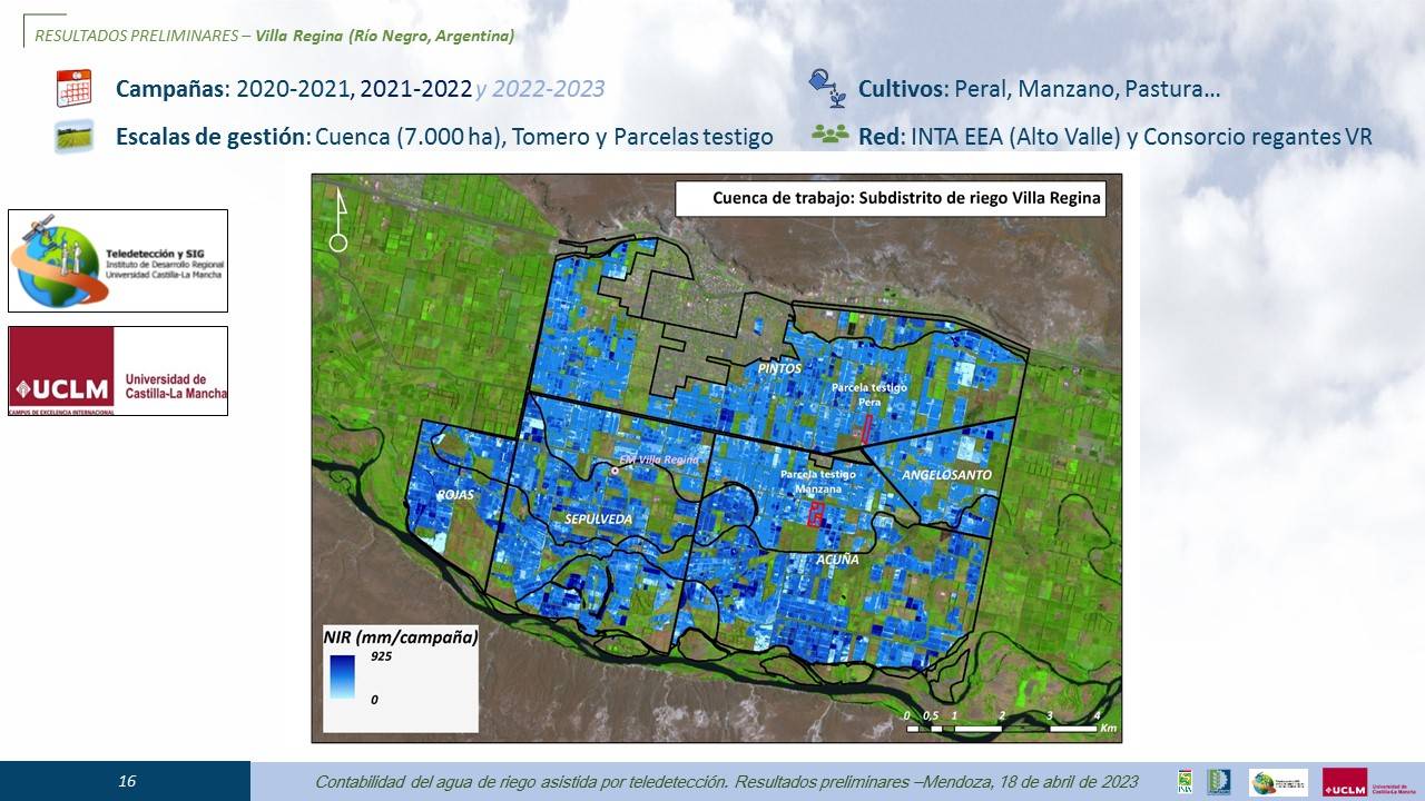
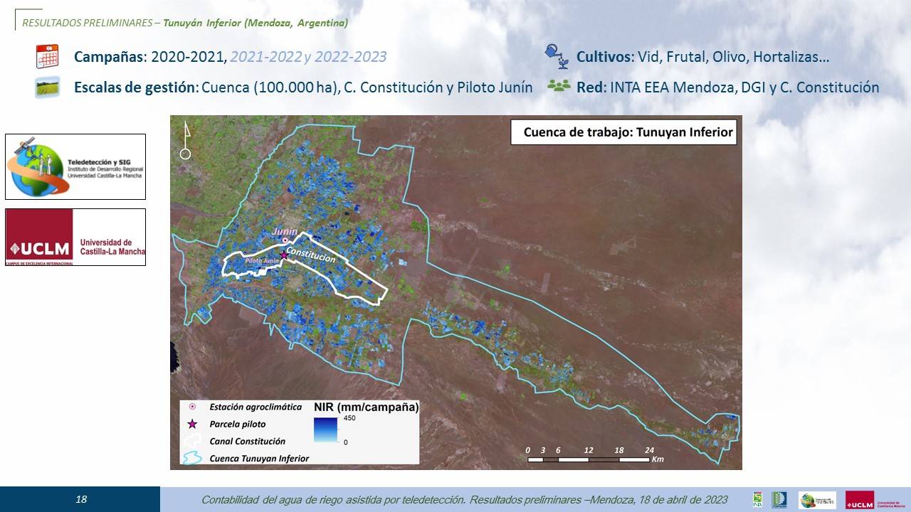
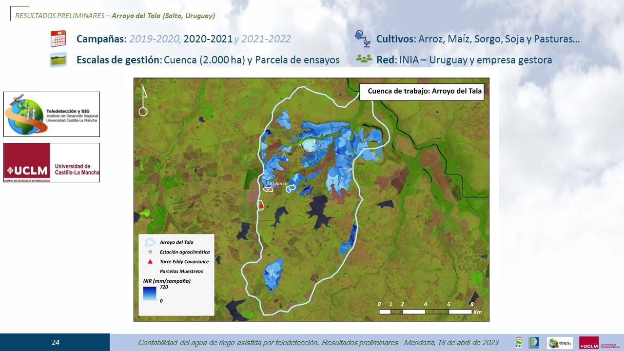
The PLAS FONTAGRO online platform allowed users quick and easy access to the NDVI vegetation index time series, as well as the basal crop coefficient. Through this platform, together with the information from the environmental demand ETo (meteorological models) forecast, it is possible to estimate crop water consumption within the pilot zones. From the information vegetation index, climate, soil and crop type, the regional water balance was estimated at a pixel scale (10 m x 10 m) for the analysis area in Chile and Spain and then grouped into analysis territories of water management. The modeled values of crop water consumption were adjusted to the allocations reported by the water administration. On a farm scale, advice was given on satellite irrigation for potatoes, lettuce, beans (Chile pilot) and irrigation analysis was established for industrial tomatoes (San Juan) and vineyards (Mendoza).


Support from space for water efficiency
SATELLITE AGRICULTURAL PLATFORM TO ESTIMATE THE IRRIGATION NEEDS OF CROPS
Participating Organizations
 - Colombia")
 - Chile")
 - España")
 - Uruguay")
 - Chile")
 - España")
 - Chile")
 - Argentina")
 - Chile")
 - España")
 - Uruguay")
 - Argentina")
 - Colombia")
 - Argentina")
 - Argentina")


